Apple Maps team going into three new cities with mapping backpacks

What you need to know
- The Apple Maps team is taking mapping backpacks into three cities.
- London, Birmingham, and Manchester will be scanned with backpacks.
- The company is using backpacks in areas that are inaccessible by cars.
Apple is getting ready to enhance its map in three more cities.
According to a new report from Bloomberg, the Apple Maps ground team has ascended onto the streets of London, Birmingham, and Manchester with their handy backpacks to capture pedestrian-level mapping data in all three cities.
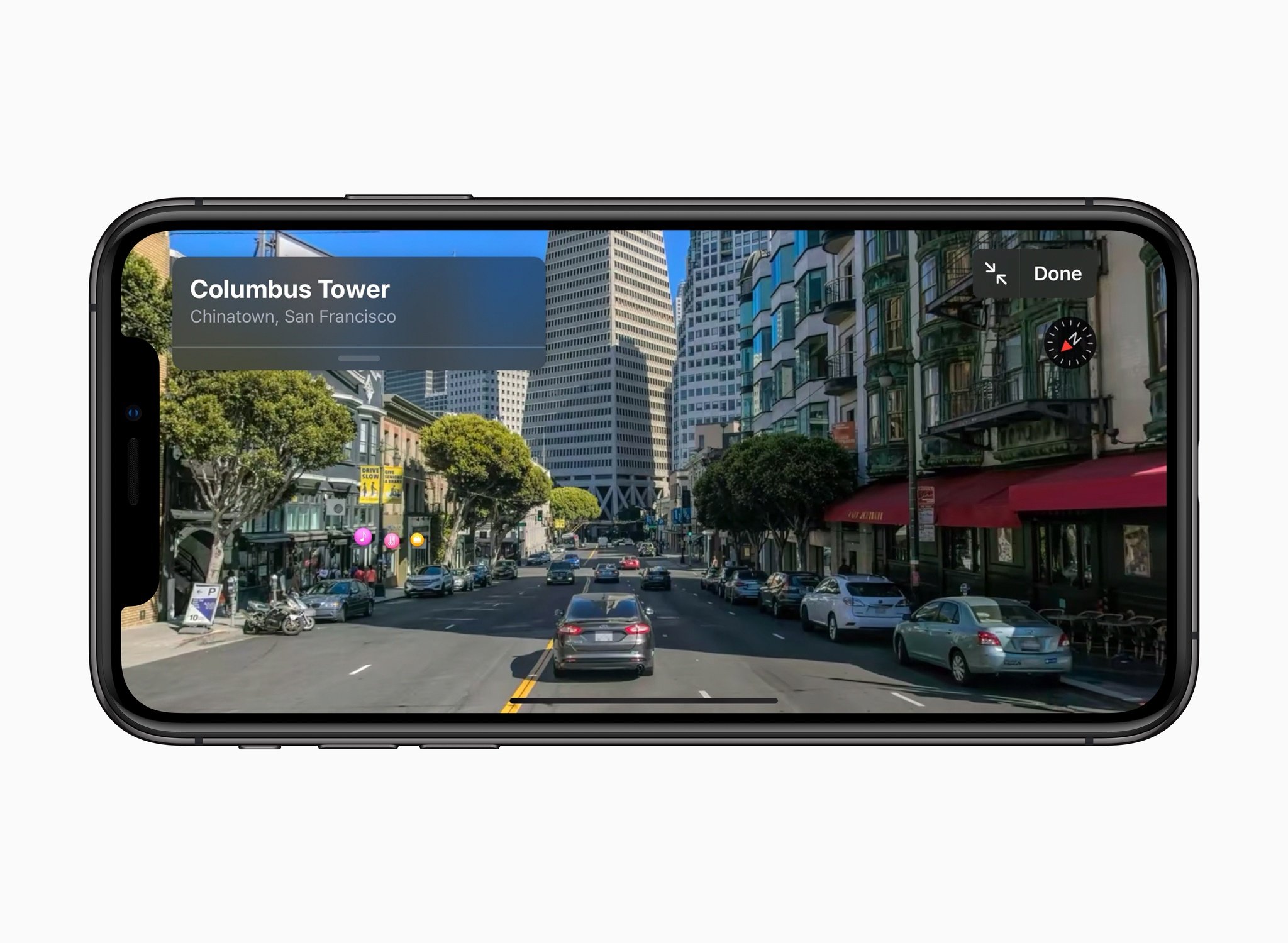
Apple says that it is using the backpacks in areas where it is not possible to drive in order to boost its Look Around feature for Apple Maps.
Starting on Monday and running until mid-May, the backpacks - which feature cameras and other sensors for mapping data collection - will begin to appear in areas of the three cities where it is not possible to drive.The data gathering is part of a project to improve Apple Maps and its Look Around feature, which enables app users to jump into the map and get a street-level view of an area to help navigate or find nearby businesses.Apple said it will use the backpacks in pedestrianised streets, parks, city squares and transit stations where it is not possible to use sensor-mounted cars, and in order to create more accurate 2D maps of these locations.
According to the report, the company is using the technology to scan The Bullring, New Street, and Edgbaston Street in Birmingham. In Manchester, St Peter's Square, Shambles Square, and Albert Square will be scanned using backpacks.
Apple says that, in order to maintain people's privacy, it will censor faces and license plates that are captured during the scanning.
"Apple is conducting ground surveys with vehicles around the world to collect data to improve Apple Maps and to support the Look Around feature," the technology giant said."These pedestrian surveys allow us to improve and update Apple Maps in areas where vehicles simply can't go while using the same privacy protections as the Apple Maps vehicles."We are committed to protecting your privacy while conducting these surveys. For example, we will censor faces and license plates on images that are published in Look Around."
The features coming to all of the above cities will likely be similar to the ones recently launched in Montreal, Toronto, and Vancouver. Canada.
iMore offers spot-on advice and guidance from our team of experts, with decades of Apple device experience to lean on. Learn more with iMore!

Joe Wituschek is a Contributor at iMore. With over ten years in the technology industry, one of them being at Apple, Joe now covers the company for the website. In addition to covering breaking news, Joe also writes editorials and reviews for a range of products. He fell in love with Apple products when he got an iPod nano for Christmas almost twenty years ago. Despite being considered a "heavy" user, he has always preferred the consumer-focused products like the MacBook Air, iPad mini, and iPhone 13 mini. He will fight to the death to keep a mini iPhone in the lineup. In his free time, Joe enjoys video games, movies, photography, running, and basically everything outdoors.

