How to get transit directions in Apple Maps on iPhone
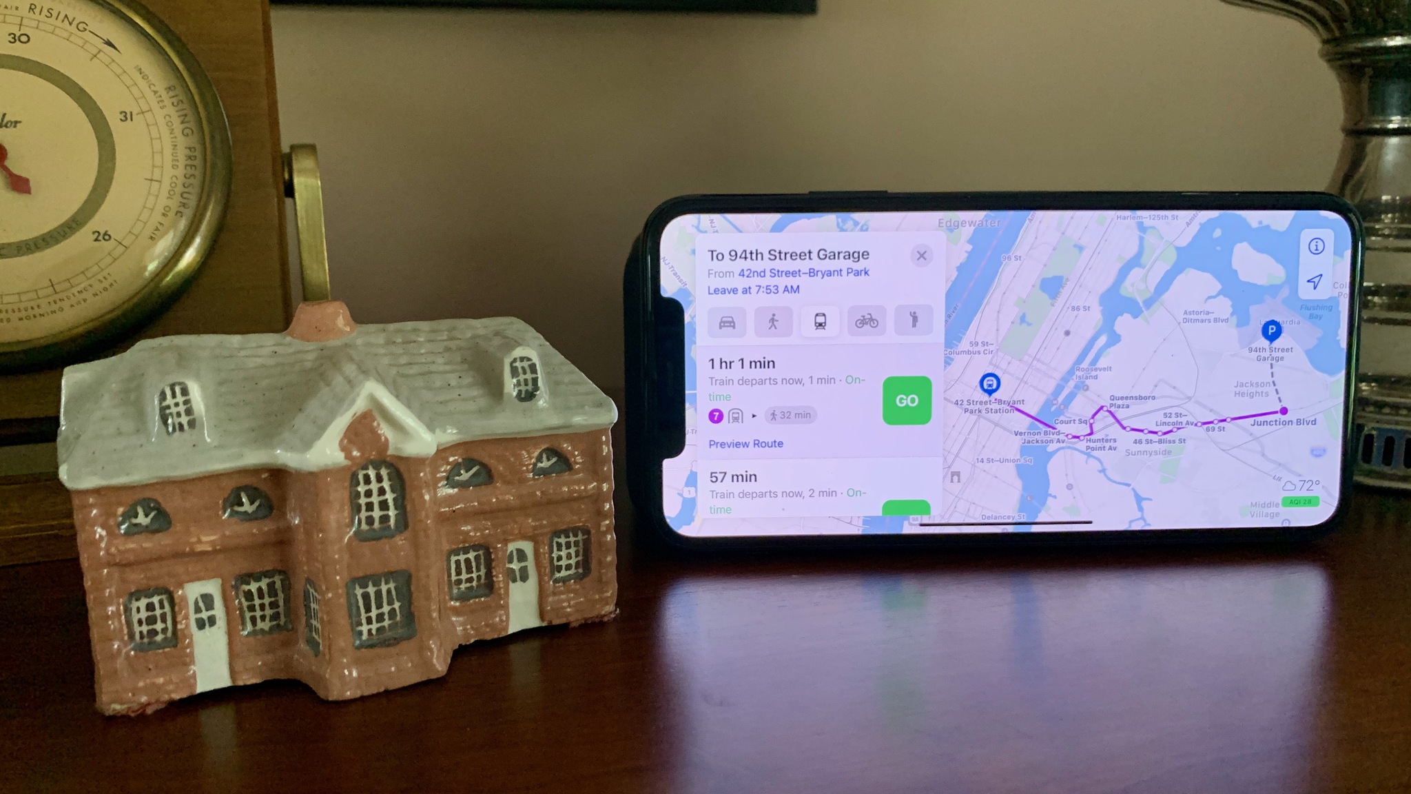
Apple has a few useful features specific to transit directions making it easier to navigate the big city without a car. You can easily see transit stops for specific lines and routes and, whenever multiple options are available, you'll see all of the possible route suggestions. Here's how to use transit directions in Apple Maps.
How to get transit directions in Apple Maps
If you are trying to get around a particular city using public transportation, you can use Apple Maps to find your way. It's easy to find transit directions in Apple Maps once you know how.
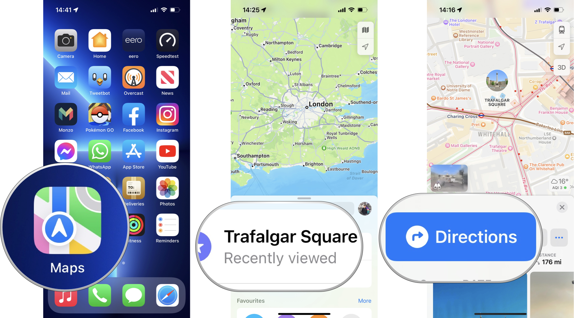
- Open Maps.
- Tap on your destination. This could be as a result of a search or a landmark on the map.
- Tap on the Directions button. This may already show an estimated time for driving, walking, cycling, or transit depending on your default mode.
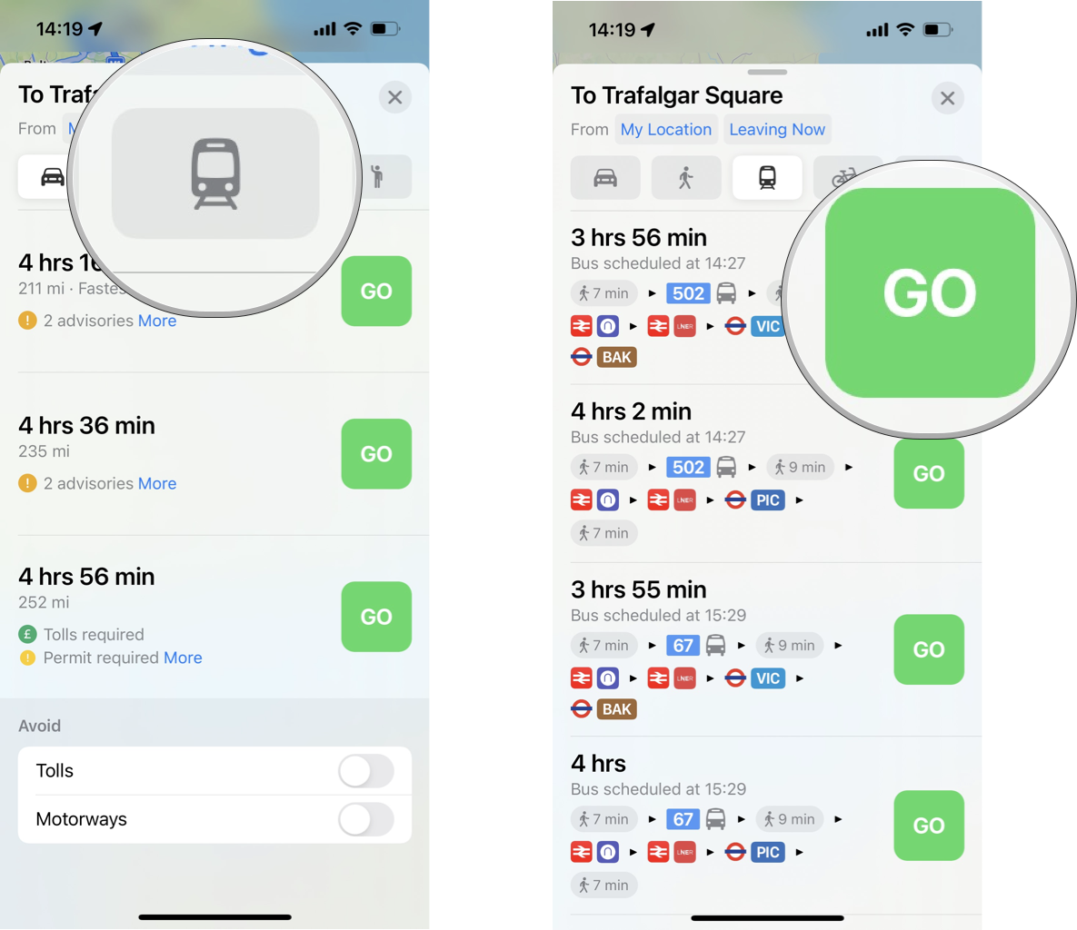
- Switch to transit directions (train icon) if this isn't already selected.
- Optionally, tap Leaving Now to change the time or date for departure or arrival.
- Tap on GO for your selected route.
Of course, you can also use Maps with Siri to get transit directions in Apple Maps. Simply say something like "Hey Siri, show me transit directions to City Hall."
Once you've hit GO, the route card will show you upcoming directions during your trip.
How to find nearby transit routes in Apple Maps
If you're in an unfamiliar city and just want to know your public transport options in your vicinity, Apple Maps has a handy built-in feature to help you out in a pinch. Here's how to quickly find nearby transit routes.
- Open Maps.
- Swipe up on the search card to reveal your Favorites.
- Tap on the + icon to add a new favorite.
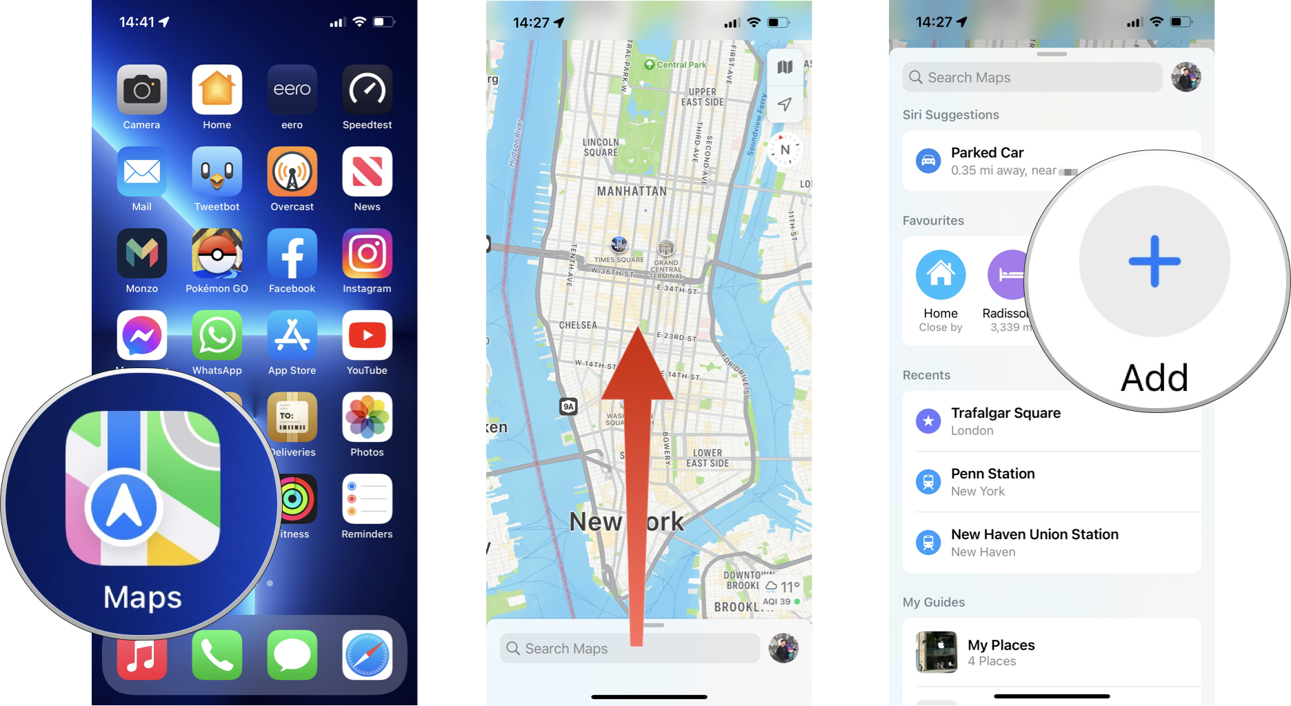
- Tap on Nearby Transit (or Nearby Public Transport, depending on your region). This will now show in your Favorites.
- Tap on Transit (or Public Transport, depending on your region) in the Favorites bar.
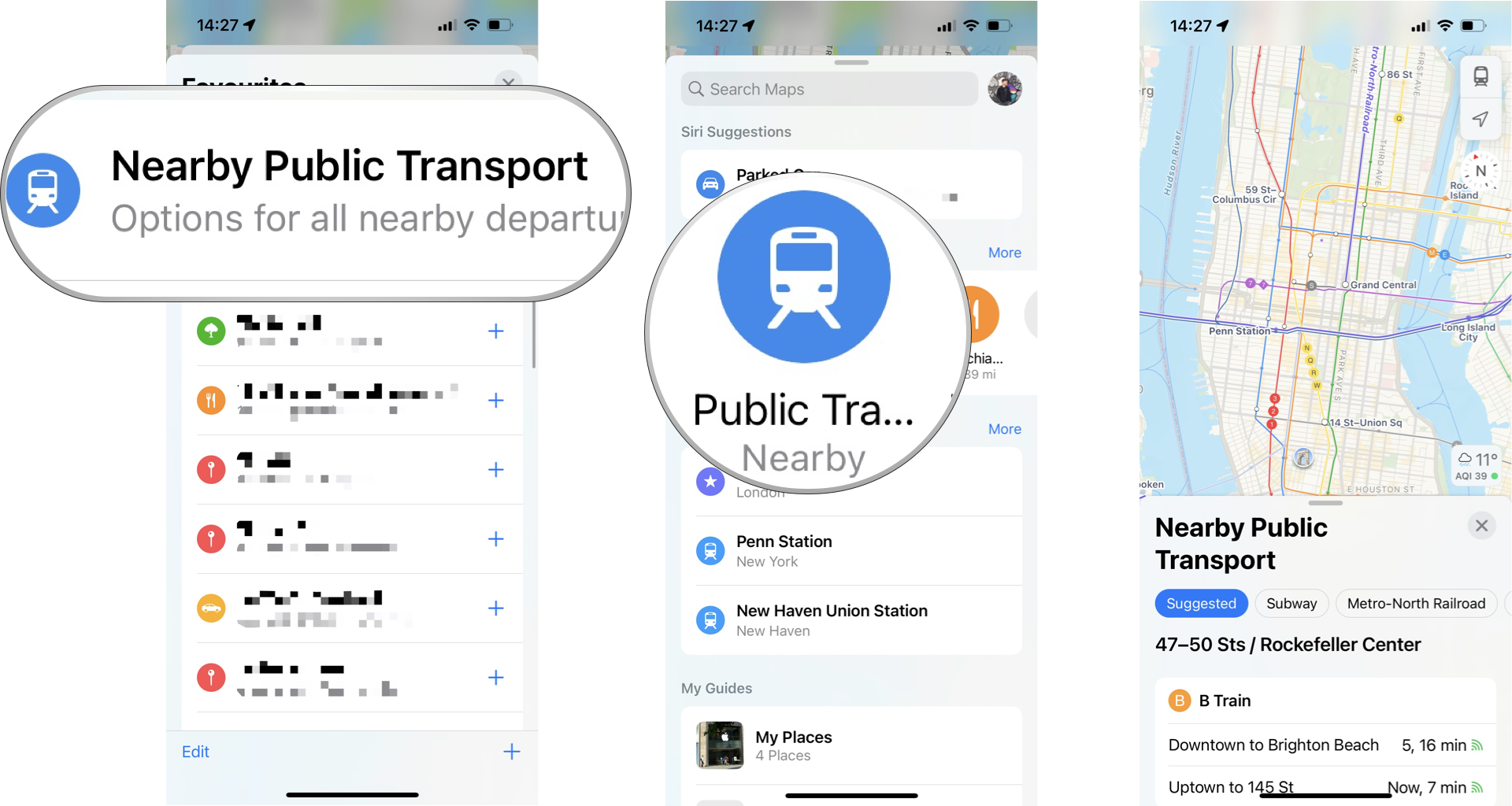
This will now reveal all known public transport options for the regions you are viewing on the map. Alternatively, you can switch your map to Transit view by tapping the map icon in the top right and selecting Transit.
How to add a transit station or stop to your Favorites in Apple Maps
Whether you want to add the nearest train station or bus stop in order to make finding your way home easier, or you're planning to use public transit a bunch for an upcoming trip to a new city, adding these locations to your Favorites can make life easier. Here's how to do it.
Master your iPhone in minutes
iMore offers spot-on advice and guidance from our team of experts, with decades of Apple device experience to lean on. Learn more with iMore!
- Open Maps.
- Tap on the station or stop. This could be as a result of a search or a landmark on the map.
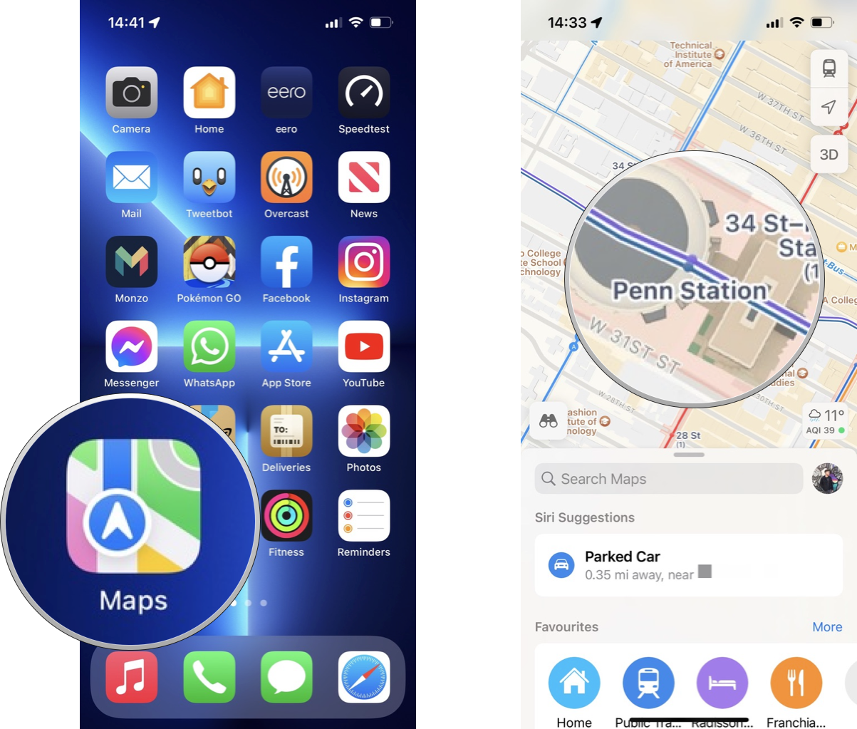
- Tap on the ••• icon on its place card.
- Tap on Add to Favorites in the pop-over menu.
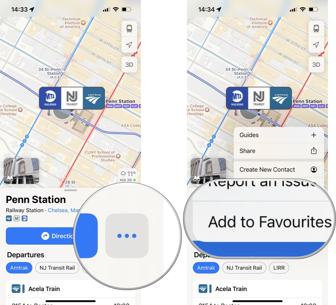
Any locations you add will now appear in the Favorites bar so you can easily navigate to them with a couple of taps. To remove a station or stop from your Favorites, simply follow the above steps and tap Remove from Favorites.
Find your way around
As you can see, the built-in Maps app is one of the best iPhone tools for navigating a new place. With transit directions in Apple Maps coming to more places with each iOS update, it's only going to become more useful over time, too.
Updated May 2022: Updated for iOS 15.
Adam Oram is a Senior Writer at iMore. He studied Media at Newcastle University and has been writing about technology since 2013. He previously worked as an Apple Genius and as a Deals Editor at Thrifter. His spare time is spent watching football (both kinds), playing Pokémon games, and eating vegan food. Follow him on Twitter at @adamoram.

